June 7, 2022
ACFHP is excited to announce that the following five projects will be receiving National Fish Habitat Partnership funding for the 2022 fiscal year.
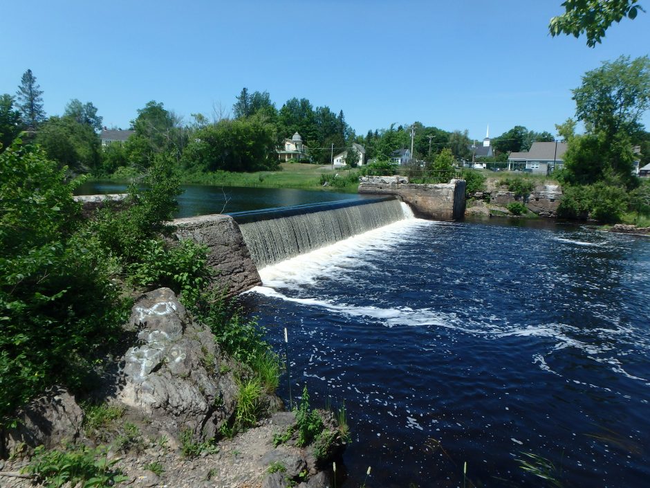
Baskahegan Lake and Crooked Brook Flowage Fish Passage Project, Danforth, Maine
This project, led by the Atlantic Salmon Federation, will restore access to 8,960 acres and 137 miles of stream habitat for alewives and other diadromous fish species through the installation of a pool and weir fishway at the Baskahegan Dam. The dam is a complete barrier to fish passage and blocks access to a substantial amount of habitat for sea-run fish species. For the first time in two centuries, alewives have been observed at the base of the dam each of the last four years. The proposed fishway will allow agencies to meet fisheries management goals for the watershed while maintaining the significant inland wading bird and waterfowl habitat created by the dam. This project builds on the tremendous success of a 30-year federal/state/tribal/NGO effort to improve habitat and restore abundant, self-sustaining populations of diadromous fish throughout the Penobscot watershed. Over time, a self-sustaining run of more than 2 million alewives is anticipated that will have far-ranging, positive ecological, social, and economic benefits throughout the watershed all the way down to Penobscot Bay and the Gulf of Maine.
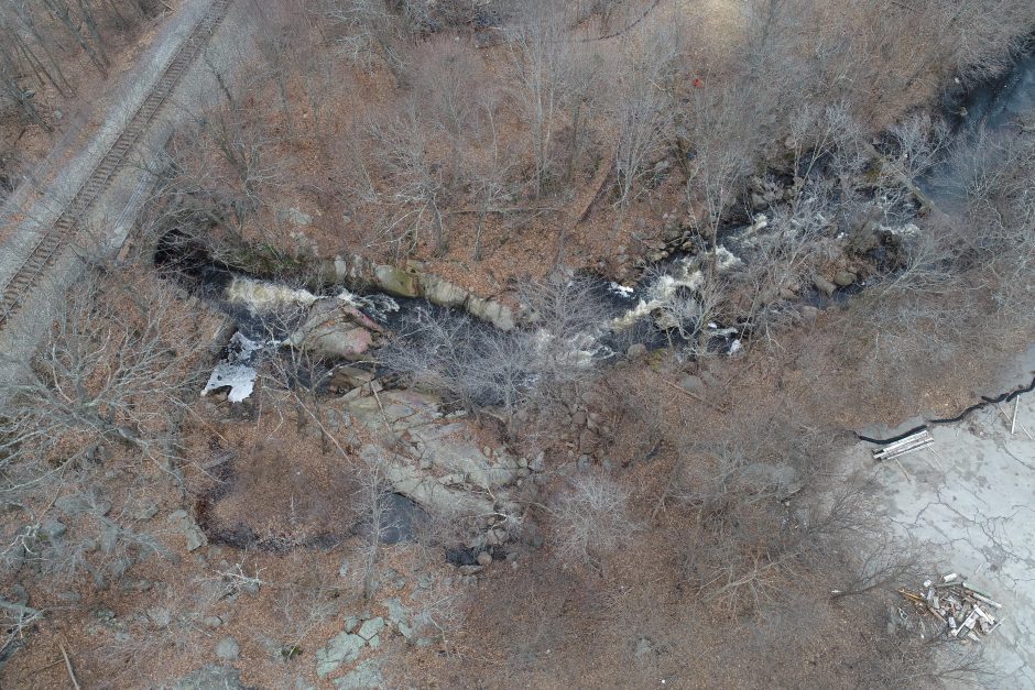
Ames Pond Dam Removal and Fishway Construction, Monatiquot River, Braintree, Massachusetts
The former mill industry along the Monatiquot River impacted historic herring runs and disconnected species from their spawning grounds. The River’s Ames Pond Dam no longer serves its original purpose and is a barrier to fish passage. Additionally, a rail bridge constructed immediately downstream of Ames Pond Dam in the 1800s altered the configuration of bedrock at the site (“Rock Falls”), further complicating fish passage. Despite these manmade barriers, a strong herring run still exists today. With this funding, the Town of Braintree will remove the Ames Pond Dam and install a pool-and-weir fishway around the Rock Falls to restore 36 miles of unimpeded upstream access to 180 acres of habitat for river herring and American eel.
The Ames Pond Dam and Rock Falls are two of three fish passage barriers on the Monatiquot River. The third barrier, the Armstrong Dam, was funded for removal by ACFHP in 2021.
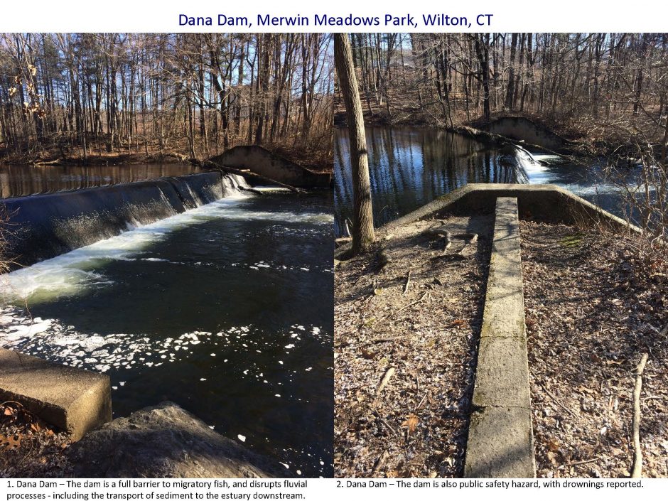
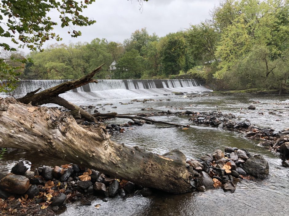
The derelict Dana Dam (also known as Strong Pond Dam) on the Norwalk River is blocking access to natural spawning and nursery habitat for diadromous fish species such as American shad, alewife, and blueback herring. This is contributing to a decline in populations of these forage fish, which are essential to the food chain and health of Long Island Sound. Through complete removal of the dam in Merwin Meadows Park, partial channel construction, partial channel realignment, and beneficial on-site sediment use, Save the Sound will restore fish passage and ecological connectivity to 6.5 upstream river miles, forming a free-flowing 17 mile stretch of the Norwalk River to Long Island Sound. The work will also remove a safety hazard; reconnect 1.13 acres of heterogeneous floodplain; reduce thermal, chemical, and other physical impacts to 1/4 mile of the Norwalk River; and educate visitors through volunteer events and interpretive signs.
Paulina Dam Removal, Paulins Kill, New Jersey
The Nature Conservancy is working with partners to remove the Paulina Dam on the Paulins Kill. The dam is an obstruction to American shad, American eel, and sea lamprey passage, which are found below the dam. Removal of this dam, along with the earlier removals of the Columbia and County Lines Dams will open and improve a total of 45 miles of mainstem and tributaries to migratory and resident fish.
The removal and subsequent bank stabilization, riparian planting, and restoration activities will: (1) improve aquatic and terrestrial connectivity as evidenced by improved fish passage and increases in target fish, mussel, and macroinvertebrate populations; (2) improve water quality and restore hydrology; and (3) enhance recreation and public safety, eliminating the risk of a potential breach.
The Paulina Dam is the downstream-most dam on the Paulins Kill, New Jersey’s third largest tributary to the Delaware River. The dam is a 13-foot high and 207-foot long timber crib, rock-filled dam originally constructed in 1895. It is classified as a Class II, Significant Hazard Dam, due to its proximity to the town of Blairstown.
Once the Chesapeake Bay’s most valuable fishery, the native oyster population has been severely depleted by overfishing, sedimentation, and pollution. Overfished reefs are subject to sedimentation because of the reduced vertical profile and density of live oysters. These low profile, sediment-laden reefs make it difficult for free-swimming oyster larvae to settle and grow. Reefs that are still functional suffer from fragmentation resulting in lower reproductive potential and less support for fish habitat and other biodiversity.
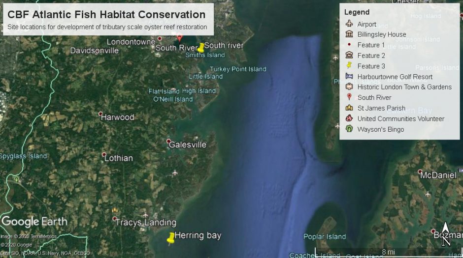
This project will augment existing hard bottom within two existing protected oyster sanctuaries along the mainstem and in a tidal tributary of Chesapeake Bay. Herring Bay will increase from 0.68 acres to 2 acres, and Glebe Bay (South River) will increase from 0.86 acres to 3 acres. Restoration of reefs in this area is designed to combat the threat of historic overfishing and sedimentation and add live native oysters to suitable reef substrate supporting the oysters themselves, adjacent aquaculture operations, and the broader estuarine food web. Chesapeake Bay Foundation will engage two communities through their existing local partnerships to expand oyster gardening efforts, design a tributary-scale oyster restoration plan, inform the process with surveying, and produce permitting documents for larger scale restoration.
To learn more about all of ACFHP’s funded and endorsed projects, visit: https://www.atlanticfishhabitat.org/on-the-ground-projects/.
