Wilmington, North Carolina
This project was funded in FY2021 through the National Fish Habitat Action Plan
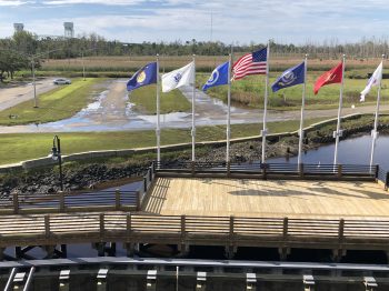
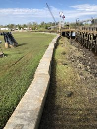
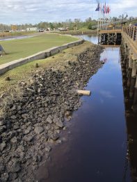
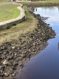
Battleship North Carolina, a National Historic Landmark berthed on the Cape Fear River near Wilmington, NC, is adjacent to 65 acres of state-owned marsh, uplands, and parkland. With a 60-year coastal riverine history, the Battleship is a sentinel site for climate change. Resting 28 miles upstream of the Atlantic Ocean, the Battleship property is hydrologically contiguous to more than 2,000 acres of tidal wetlands and intertidal shoreline on Eagles Island. Like many coastal sites, an increasing trend in tidal flooding (greater than 5.5 feet at Station WLON7) causes problems. Tidal erosion damages wildlife habitats, creates sink holes, and degrades water quality with vehicular pollutants, soil, and silt. The Battleship is committed to an on-the-ground green infrastructure solution to improve degraded fish and wildlife habitats and water quality.
This project is being led by the USS NORTH CAROLINA Battleship Commission and will mitigate the ecological and economic impacts of nuisance tidal flooding at the Landmark. Project objectives include restoration of ~800 linear feet of intertidal shoreline and establishment of ~2 acres of tidal wetland. The living shoreline and tidal wetlands will increase hydrologic function and services to the Cape Fear River, restore fish habitat, and improve water quality. Specifically, restoration will augment refuge habitat, improve benthic foraging habitat, and increase primary nursery and juvenile habitat for prey and finfish species. Improved ecosystem functions and services will also enhance population recovery of federally managed species such as the shortnose sturgeon and Atlantic sturgeon.
Text and photos provided by the USS NORTH CAROLINA Battleship Commission.
